


Why is no one talking about Indiaĺs claim line in Galwan Valley?
Mangalore Today News Network
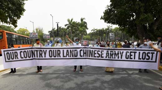
Beijig, Jun 26, 2020: China’s claims to Indian territories beyond the usual Chinese claim line are not unexpected but are indeed bewildering. They are not unexpected because that is what Communist China has been doing since her establishment, or emancipation as she prefers to call it, in 1949.
Emancipation from who, one may ask? From the so-called tyrannical forces of democracy proponent Chiang Kai-shek and his handful supporters making up the Chinese Nationalist Party, who later fled to the island of Formosa, now called Taiwan.
China is the only country in the world to have expanded its territories in the 20th century. China is slowly but steadily trying land-grabs in Indian areas including those where no difference in perception exists.
No basis of recent claims by China
Recent claims of Chinese foreign ministry spokesperson Zhao Lijian — who used the Twitter handle Muhammad Lijian Zhao till 2017 when he was posted in Pakistan — to the Galwan estuary are astonishingly foolish.
There is no basis to China’s claims on Aksai Chin. The Chinese forcefully came into this part of India when they occupied Tibet in the 1950s. The PLA occupied Aksai Chin partly and constructed a road connecting Tibet with occupied East Turkestan, now called Xinjiang province.
Later in 1962 when India was vulnerable, Communist Party of China (CCP) expanded their occupation up to what today is the Chinese claim line (CCL).
India’s claim line is the Johnson Line, the traditional boundary of erstwhile State of Jammu and Kashmir. The Ardagh Johnson Line which extends to certain parts of Xinjiang has a valid historical basis, thus underlining India’s claim.
Payment of taxes in areas around Kailash Mansarovar
Zorawar Singh Kahluria, a subordinate general of Kashmir Maharaja Gulab Singh, himself a vassal of Sikh ruler Maharaja Ranjit Singh, conquered western parts of Tibet, including Pangong Tso, in the early 19th century.
The barren yet vast areas of eastern Ladakh have been neglected by India after Independence due to the chaos and strife that ensued after Partition.
The land and financial records of Government of India, however, clearly show that taxes were paid by villages around the Holy Parikrama of Kailash Mansarovar, including Taklakot.
After China occupied these territories in the 1950s and later in 1960s, the practice was curbed and stopped.
New maps published by China
New maps of China were published in January 2015. They contain areas claimed by China, including in the South China Sea where it was indicated by nine-dash lines.
The Chinese boundary was indicated by three thick lines in this map covering an almost 150-200km wide area. The blue line seems to be more close to the actual boundary is roughly 10-40km wide.
These maps were neither accepted by any of China’s neighbours nor by the rest of the world.
Galwan claim busted
The recent Galwan Estuary claims although purposely brazen, are very serious in nature.
The claim to areas up to the Galwan mouth indicate China’s intentions to stop progress on the strategically important Darbuk - Shyok - Daulat Beg Oldie (DSDBO) road being constructed by the Border Roads Organisation (BRO) of India.
The Baidu Ditu (Baidu Maps), a Google Earth equivalent of China, gives out the official version of their claim line with India.
Even that clearly indicates that the present Line of Actual Control (LAC) is more than 5km east of the Galwan estuary.
courtesy:IndiaToday
 Write Comment
 E-Mail To a Friend
 Facebook
 Twitter
  Print
Print - Belthangady: Banjarumale records 100% voter turnout in Lok Sabha polls
- Dakshina Kannada, Udupi sees voter turnout of nearly 72%
- Mangaluru International Airport initiates work on precision approach lighting system
- Sandalwood star Rakshit Shetty casts his vote in Udupi, Watch
- Brisk polling across Dakshina Kannada constituency
- Ashta Mutt pontiffs cast vote in Udupi
- Udupi: Candidates Jayaprakash Hegde, Kota Srinivas Poojary exercise franchise
- Vittal: EVM technical glitch delays voting at Karopady booth
- Orange alert: Karnataka State Disaster Management cell gives animated advisory
- Lok Sabha elections 2024: Voting underway in 14 constituencies in Karnataka
- Mangaluru: Activists clash with media, police at Capitanio
- Karnataka Lok Sabha election: Voting timings, Key candidates and phase 2 polling constituencies
- Sullia: Rider dies in bike-jeep collision
- Case Against BJP Leader CT Ravi Over Social Media Post: Karnataka Poll Body
- Lok Sabha polls-24: 63% voter turnout recorded in phase 2
- LS elections 2024: Left rattled by allegations of CPI(M) veteran’s plans to join BJP
- Tejasvi Surya booked for ÔÇÖseeking votes in the name of religionÔÇÖ on polling day
- ÔÇśHe will shed tearsÔÇÖ: Rahul GandhiÔÇÖs sharp attack on PM Narendra Modi
- Lok Sabha elections: 4 men collapse and die amid Phase 2 voting in Kerala
- BJP becomes first Indian party to cross Rs 100 crore ad spend on Google
- 78 year old woman, on oxygen support, casts vote in Bengaluru
- Long queues outside Bengaluru hotel for free Benne Dosa, Ghee Laddu on polling day, Watch
- What happens if NOTA gets maximum votes? Supreme Court notice to poll body
- BJP candidate K Sudhakar booked for ÔÇÖBriberyÔÇÖ in Karnataka, Rs 4.8 Cr cash seized
- 2 Terrorists dead, 2 army personnel injured as gunbattle resumes in J&KÔÇÖs Baramulla
- New residential complex for the judges inaugurated in Mangaluru
- Absconding accused nabbed after 8 years
- Truck with cylinders turns turtle in Beltangady
- Bhoota Kola artist dies of cardiac arrest
- Development of the country should be our goal: Ganesh Karnik
- Container truck gets stuck under Modankap railway bridge
- Truck crushes bike’s pillion rider near BC Road
- Head constable dies of heart attack
- Udupi: PDO dismissed over financial irregularities
- CREDAI to resume Skill Development Program for Construction Workers in Mangaluru
- John B Monteiro elected president of Rachana Catholic Chamber of Commerce & Industry
- Sudhanshu Rai elected district president of All College Student Association
- Chief Minister to visit Mangaluru, Udupi on August 1
- Nitte University awards PhD degree to Tina Sheetal D’Souza
- Sachitha Nandagopal honoured by CMTAI for Community Service


- Local Search
- Classifieds
- CITY INFORMATION
- TRAVEL
- TOURIST INFORMATION
- HEALTH CARE
- MISCELLANEOUS
© 2024 All rights reserved. MangaloreToday