
DC approves route map for four-laning of NH 169
Mangalore Today News Network
Mangaluru, Jan 11, 2018: DC approved the final route map for fourlaning of NH 169 of Kulshekar-Moodbidri-Karkala stretch. Based on the geographic condition of the region, NHAI has started its work on the road design.
 The 45-km stretch was pending for four years. Owing to pressure to change the alignment and restrict the width of the road, the map was not finalised. The work related to widening of the road accelerated in August. The elected representatives and district administration held talks with the land owners. The NHAI officials have now finalised the route map.
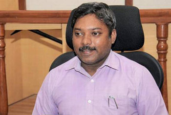
Project director of NH 169 widening project S P Somashekar said, “The DC has given his approval for the map. The design work has been taken up by Feed Back Infra company.” The map of the proposed widening of the national highway at Sanooru, Moorthangadi, Thodaru, Mijaru, Edapadavu and Kudupu have been changed. A proposal for constructing a bridge across Gurpura river beside the existing bridge has also been planned.”
According to the initial plan, the road was supposed to pass through the premises of Rosa Mistika School in Gurpura. However, the management of the institution had appealed to the authorities to change the alignment. MLA J R Lobo, who held a meeting, has solved the problem. Some minor changes have been made at Kulshekar, Somashekar said.
Engineers from Feed Back Infra company will design the road and submit a report to the NHAI within two months. Approvals will be sought from the Deputy Commissioner for the report. Later, a notification will be issued for land acquisition.
As per the plan, it has been proposed to lay two bypass roads at Kaikamba and Moodbidri. Two over bridges will be constructed at two locations, explained the project director. It has also proposed to construct underbridges at 10 locations for the movement of heavy vehicles and eight underbridges for the movement of light vehicles.