


India reacts sharply to Nepal releasing new map; calls it unjustified cartographic assertion
Mangalore Today News Network
New Delhi, May 20, 2020: In a strong reaction to Nepal releasing a new political map showing areas like Lipulekh and Kalapani under its territory, India on Wednesday said such artificial enlargement of territorial claims will not be acceptable to it and asked the neighbouring country to refrain from ’unjustified cartographic assertion’.
India’s reaction came hours after the Nepal government released a revised political and administrative map of the country showing Limpiyadhura, Lipulekh and Kalapani under its territory,Yahoo reported.
’This unilateral act is not based on historical facts and evidence. It is contrary to the bilateral understanding to resolve the outstanding boundary issues through diplomatic dialogue,’ External Affairs Ministry Spokesperson Anurag Srivastava said.
’Such artificial enlargement of territorial claims will not be accepted by India,’ he said.
Srivastava also asked Nepal to respect India’s sovereignty and territorial integrity, hoping that the Nepalese leadership will create a positive atmosphere for diplomatic dialogue to resolve the outstanding boundary issues.
’Nepal is well aware of India’s consistent position on this matter and we urge the government of Nepal to refrain from such unjustified cartographic assertion and respect India’s sovereignty and territorial integrity,’ he said.
The new map was released by Nepal’s Land Reforms Minister Padma Aryal during a televised press conference in Kathmandu.
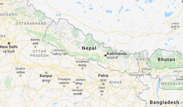
The Lipulekh pass is a far western point near Kalapani, a disputed border area between Nepal and India. Both India and Nepal claim Kalapani as an integral part of their territory - India as part of Uttarakhand’s Pithoragarh district and Nepal as part of Dharchula district.
Nepalese Foreign Minister Pradeep Kumar Gyawali last week summoned Indian Ambassador Vinay Mohan Kwatra and handed over a diplomatic note to protest against India inaugurating a key road connecting the Lipulekh pass with Dharchula in Uttarakhand.
India has maintained that the road section in Pithoragarh district in Uttarakhand lies completely within its territory.
Days later, Indian Army chief Gen MM Naravane said that there were reasons to believe that Nepal objected to the road at the behest of ’someone else’, in an apparent reference to a possible role by China on the matter
 Write Comment
 E-Mail To a Friend
 Facebook
 Twitter
  Print
Print - Karnataka Lok Sabha election: Voting timings, Key candidates and phase 2 polling constituencies
- Sullia: Rider dies in bike-jeep collision
- Mangaluru: Mustering process held ahead of LS polls
- Mangaluru: BJP accuses Congress of circulating fake pamphlet
- Over 2.88 crore voters in Karnataka to cast their franchise on April 26
- Communally sensitive DK dist was a narrative created by few: Captain Brijesh Chowta
- BJP protests against Congress government’s ‘anti-people’ policies
- Renowned Yakshagana Bhagavatha Subrahmanya Dhareshwar no more
- People must support Congress to develop DK as land of harmony: Padmaraj
- Railways to operate special trains to clear extra rush during election day
- BJP, Congress candidates end campaign by conducting roadshows in Mangaluru
- There is no Modi wave in DK: Harish Kumar
- Railways to operate election special trains from Bengaluru to Mangaluru, Kundapura
- Educational, financial institution shut due to Lok Sabha election 2024 in these areas
- Supreme Court verdict tomorrow on 100% EVM-VVPAT verification
- 6 Dead as massive fire engulfs Patna hotel, over 50 feared trapped, watch
- Horlicks, Boost drop ’Health’ label, rebranded as "Functional, Nutritional drink"
- Not One Vote: Mamata Banerjee’s big message after 26,000 teachers lose jobs
- On complaints against PM Modi, Rahul Gandhi, poll body’s notice to parties
- RBI plans curbs on suspect bank accounts to fight cyber fraud: Report
- Sunita Kejriwal to lead AAP’s Lok Sabha campaign in Delhi, hold roadshows
- ’Desperation born from fear of defeat’: Siddaramaiah slams Modi, defends 4% Muslim quota
- ED challenges Arvind Kejriwal’s plea in Supreme Court: ’173 phones destroyed’
- 103-year-old CSK fan flaunts love for cricket, wishes to meet MS Dhoni
- How an Indian heart saved a Pakistani teen’s life
- New residential complex for the judges inaugurated in Mangaluru
- Absconding accused nabbed after 8 years
- Truck with cylinders turns turtle in Beltangady
- Bhoota Kola artist dies of cardiac arrest
- Development of the country should be our goal: Ganesh Karnik
- Container truck gets stuck under Modankap railway bridge
- Truck crushes bike’s pillion rider near BC Road
- Head constable dies of heart attack
- Udupi: PDO dismissed over financial irregularities
- CREDAI to resume Skill Development Program for Construction Workers in Mangaluru
- John B Monteiro elected president of Rachana Catholic Chamber of Commerce & Industry
- Sudhanshu Rai elected district president of All College Student Association
- Chief Minister to visit Mangaluru, Udupi on August 1
- Nitte University awards PhD degree to Tina Sheetal D’Souza
- Sachitha Nandagopal honoured by CMTAI for Community Service


- Local Search
- Classifieds
- CITY INFORMATION
- TRAVEL
- TOURIST INFORMATION
- HEALTH CARE
- MISCELLANEOUS
© 2024 All rights reserved. MangaloreToday